
ISBN: 9781566953467
• Waterproof • Tear-Resistant • Topographic MapVirgin Islands National Park is an island paradise of white sand beaches and turquoise water. Created in cooperation with the… Mehr…
| BarnesandNoble.com new in stock. Versandkosten:zzgl. Versandkosten. Details... |

2001, ISBN: 9781566953467
[ED: Karte], [PU: NATL GEOGRAPHIC MAPS], Neuware - Trails Illustrated topographic maps are the most detailed and up-to-date recreation maps available for these national parks, national fo… Mehr…
| booklooker.de |

2012, ISBN: 9781566953467
Trails Illustrated National Parks, Karte/Globus, Karte (gefalzt), 2020th ed. Trails Illustrated topographic maps are the most detailed and up-to-date recreation maps available for these n… Mehr…
| lehmanns.de Versandkosten:sofort lieferbar. (EUR 0.00) Details... |

2012, ISBN: 1566953464
Virgin Islands Nationalpark inkl. St. John, Virgin Islands National Park in its entirety, Virgin Islands Coral Reef National Monument, Mount Sage national Park, Tortola Island, Great That… Mehr…
| Weltbild.de Nr. 50003792. Versandkosten:, 2-5 Werktage, DE. (EUR 0.00) Details... |
2012, ISBN: 9781566953467
Trails Illustrated National Parks, Karte/Globus, Karte (gefalzt), 2020th ed. [PU: National Geographic Maps], National Geographic Maps, 2012
| lehmanns.de Versandkosten:sofort lieferbar. (EUR 0.00) Details... |

ISBN: 9781566953467
• Waterproof • Tear-Resistant • Topographic MapVirgin Islands National Park is an island paradise of white sand beaches and turquoise water. Created in cooperation with the… Mehr…

2001, ISBN: 9781566953467
[ED: Karte], [PU: NATL GEOGRAPHIC MAPS], Neuware - Trails Illustrated topographic maps are the most detailed and up-to-date recreation maps available for these national parks, national fo… Mehr…
2012
ISBN: 9781566953467
Trails Illustrated National Parks, Karte/Globus, Karte (gefalzt), 2020th ed. Trails Illustrated topographic maps are the most detailed and up-to-date recreation maps available for these n… Mehr…

2012, ISBN: 1566953464
Virgin Islands Nationalpark inkl. St. John, Virgin Islands National Park in its entirety, Virgin Islands Coral Reef National Monument, Mount Sage national Park, Tortola Island, Great That… Mehr…
2012, ISBN: 9781566953467
Trails Illustrated National Parks, Karte/Globus, Karte (gefalzt), 2020th ed. [PU: National Geographic Maps], National Geographic Maps, 2012
Bibliographische Daten des bestpassenden Buches

| Autor: | |
| Titel: | |
| ISBN-Nummer: |
• Waterproof • Tear-Resistant • Topographic Map
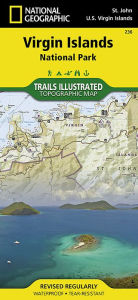
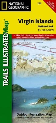
Virgin Islands National Park is an island paradise of white sand beaches and turquoise water. Created in cooperation with the National Park Service and others, National Geographic’s Trails Illustrated map of Virgin Islands National Park is a complete travel guide to to this tropical wonderland. Ferry routes will get you to the main visitor center at Cruz Bay. Use the trail guide, with trail descriptions, lengths and hiking times, to select a suitable route. Follow the trail on the topographic map that is complete with contour lines and elevations, as well as key points of interest and nearby facilities, including parking, campgrounds. showers, picnic areas, restrooms and beaches.
Descriptions of the snorkeling areas along with a snorkeling and diving ethics guide is provided. Areas of coral reefs are marked on the map as are the boundaries of Virgin Islands Coral Reef National Monument. For those who prefer navigating their own boat, anchoring information, safety tips and regulations are included. The color-coded buoys surrounding the island are displayed on the map as are scuba moorings. Information about birdwatching and park vegetation along with illustrations of a number of bird species and local flora is provided as well. The map also covers nearby Great Thatch Island, Little Thatch Island, Frenchmans Cay, Tortola Island, Dog Island, Lovango Cay and Durloe Cays.
Every Trails Illustrated map is printed on "Backcountry Tough" waterproof, tear-resistant paper. A full UTM grid is printed on the map to aid with GPS navigation.
Other features found on this map include: Saint John, Virgin Islands Coral Reef National Monument, Virgin Islands National Park.
Map Scale = 1:22,000Sheet Size = 37.75" x 25.5"Folded Size = 4.25" x 9.2Detailangaben zum Buch - Virgin Islands National Park
EAN (ISBN-13): 9781566953467
ISBN (ISBN-10): 1566953464
Gebundene Ausgabe
Taschenbuch
Erscheinungsjahr: 2010
Herausgeber: National Geographic Maps
2 Seiten
Gewicht: 0,091 kg
Sprache: eng/Englisch
Buch in der Datenbank seit 2007-03-31T19:00:50+02:00 (Vienna)
Detailseite zuletzt geändert am 2024-02-28T14:51:12+01:00 (Vienna)
ISBN/EAN: 1566953464
ISBN - alternative Schreibweisen:
1-56695-346-4, 978-1-56695-346-7
Alternative Schreibweisen und verwandte Suchbegriffe:
Autor des Buches: national geographic maps
Titel des Buches: island trails, islands, best national geographic, virgin, national geographic maps, national geographic map, national geographic 2020, national geographic englisch, polychrome
Weitere, andere Bücher, die diesem Buch sehr ähnlich sein könnten:
Neuestes ähnliches Buch:
0749717002630 Grand Canyon West, AZ: NATIONAL GEOGRAPHIC Trails Illustrated National Parks: Outdoor Recreation Map. Grand Canyon National Park Arizona, USA (National Geographic Trails Illustrated Map, Band 263) (National Geographic Maps)
- 0749717002630 Grand Canyon West, AZ: NATIONAL GEOGRAPHIC Trails Illustrated National Parks: Outdoor Recreation Map. Grand Canyon National Park Arizona, USA (National Geographic Trails Illustrated Map, Band 263) (National Geographic Maps)
- 0749717009905 Acadia National Park, ME: National Geographic Trails Illustrated USA Nordosten: Outdoor Recreation Map. Isle Au Haut, Mount Desert Island, and ... Geographic Trails Illustrated Map, Band 212) (National Geographic Maps)
- 9780516077413 Virgin Islands National Park (Radlauer, Ruth)
< zum Archiv...