
ISBN: 1566953375
[SR: 173314], Map, [EAN: 9781566953375], Folded Map, National Geographic Maps, National Geographic Maps, Book, [PU: National Geographic Maps], National Geographic Maps, • Waterproof… Mehr…
| amazon.com Goodwill of Silicon Valley Gebraucht Versandkosten:Usually ships in 1-2 business days, zzgl. Versandkosten Details... |
ISBN: 1566953375
[SR: 173314], Map, [EAN: 9781566953375], Folded Map, National Geographic Maps, National Geographic Maps, Book, [PU: National Geographic Maps], National Geographic Maps, • Waterproof… Mehr…
| amazon.com |

2019, ISBN: 1566953375
[EAN: 9781566953375], Neubuch, [PU: National Geographic Maps, United States], Language: English. Brand new Book. - Waterproof - Tear-Resistant - Topographic MapNational Geographic's Trail… Mehr…
| AbeBooks.de The Book Depository, London, United Kingdom [54837791] [Rating: 5 (von 5)] NEW BOOK. Versandkosten: EUR 0.58 Details... |

2012, ISBN: 9781566953375
Trails Illustrated, 2014th ed., Karte (gefalzt), Karte/Globus, [PU: National Geographic Maps]
| lehmanns.de Versandkosten:Versand in 5-7 Tagen, , Versandkostenfrei innerhalb der BRD. (EUR 0.00) Details... |


ISBN: 1566953375
[SR: 173314], Map, [EAN: 9781566953375], Folded Map, National Geographic Maps, National Geographic Maps, Book, [PU: National Geographic Maps], National Geographic Maps, • Waterproof… Mehr…

National Geographic Maps - Trails Illustrated:
Green Mountain Reservoir, Ute Pass (National Geographic Trails Illustrated Map) - neues BuchISBN: 1566953375
[SR: 173314], Map, [EAN: 9781566953375], Folded Map, National Geographic Maps, National Geographic Maps, Book, [PU: National Geographic Maps], National Geographic Maps, • Waterproof… Mehr…
2019
ISBN: 1566953375
[EAN: 9781566953375], Neubuch, [PU: National Geographic Maps, United States], Language: English. Brand new Book. - Waterproof - Tear-Resistant - Topographic MapNational Geographic's Trail… Mehr…
2019, ISBN: 1566953375
[EAN: 9781566953375], Neubuch, [PU: National Geographic Maps, United States], Language: English. Brand new Book. - Waterproof - Tear-Resistant - Topographic MapNational Geographic's Trail… Mehr…
2012, ISBN: 9781566953375
Trails Illustrated, 2014th ed., Karte (gefalzt), Karte/Globus, [PU: National Geographic Maps]
Bibliographische Daten des bestpassenden Buches

| Autor: | |
| Titel: | |
| ISBN-Nummer: |
• Waterproof • Tear-Resistant • Topographic Map
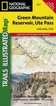
National Geographic’s Trails Illustrated map of Green Mountain Reservoir and Ute Pass provides unparalleled detail for outdoor enthusiasts seeking to enjoy the region's year-round recreational opportunities. Expertly researched and created in partnership with the U.S. Forest Service, Bureau of Land Management and others, this map covers many popular recreation areas in and around White River and Arapaho National Forests, including Eagles Nest and Ptarmigan Peak Wilderness areas, Radium State Wildlife Area, Blue River, Williams Fork Mountains, Gore Range, Elliott Ridge,Green Mountain Reservoir, Cataract Lakes.
Explore the area by following the map to pinpointed trailheads and then along mapped trails, labeled for hiking or motorized use. Many trails include mileage markers. To aid in your navigation, the map includes contour lines, elevations, labeled peaks and summits, water features, selected waypoints, areas of wooded cover and the Forest Service numbered road network. Some Forest Service roads are labeled for bike, cross-country ski or snowmobile use. Among other mapped recreation features are campgrounds, equestrian and primitive campsites, picnic areas, boat launch points, fishing holes (including gold medal fishing streams) and wildlife viewing areas. Provided are survival tips, wilderness regulations, Leave No Trace guidelines and essential contact information.
Every Trails Illustrated map is printed on "Backcountry Tough" waterproof, tear-resistant paper. A full UTM grid is printed on the map to aid with GPS navigation.
Other features found on this map include: Arapaho National Forest, Eagles Nest Wilderness, Gore Range, Green Mountain Reservoir, Mount Powell, White River National Forest, Williams Fork Mountains.
Map Scale = 1:40,680Sheet Size = 22" x 32"Folded Size = 4" x 7.Detailangaben zum Buch - Green Mountain Reservoir/ute Pass
EAN (ISBN-13): 9781566953375
ISBN (ISBN-10): 1566953375
Erscheinungsjahr: 2010
Herausgeber: National Geographic Maps
2 Seiten
Sprache: eng/Englisch
Buch in der Datenbank seit 2011-03-25T14:02:22+01:00 (Vienna)
Detailseite zuletzt geändert am 2021-02-24T21:53:46+01:00 (Vienna)
ISBN/EAN: 9781566953375
ISBN - alternative Schreibweisen:
1-56695-337-5, 978-1-56695-337-5
Alternative Schreibweisen und verwandte Suchbegriffe:
Autor des Buches: national geographic maps
Titel des Buches: ute, before they pass away
Daten vom Verlag:
Titel: Green Mountain Reservoir - NATIONAL GEOGRAPHIC Trails Illustrated Colorado
Verlag: National Geographic Maps
Sprache: Englisch
9,99 € (DE)
10,30 € (AT)
Not available (reason unspecified)
CB; GEF; Karten, Globen / Reisen/Karten, Stadtpläne, Atlanten/Nordamerika, Mittelamerika; Landkarten und Atlanten; Nordamerika
< zum Archiv...